Forecast shows drier summer for 2026

A late winter photo from an apple orchard in Frenchman Hills. While the winter of 2025/26 saw abnormal winter weather conditions for La Nina in the PNW, the winter of 2026/27 will be in El Nino which means lower precipitation overall, but eastern Washington will experience normal levels.
CALEB PEREZ/BASIN BUSINESS JOURNAL

A Moses Lake firefighter tackles a flame in a field mid-June of 2025. This summer is slated to have warmer and dryer conditions due to the lack of precipitation in the winter of 2025/26 and the predicted short wet season in spring of 2026.

Gloomy skies over Neppel Landing in Moses Lake during the fall of 2025. The fall of 2026 is predicted to see a dry start to the season and will see very little precipitation.

Map of El Nino weather patterns and how that impacts specific regions of the United States. With the PNW entering into El Nino in 2026, warmer and drier weather is expected.

Map of La Nina weather patterns and how that impacts specific regions of the United States. Weather has been in the La Nina pattern for the last two years and will be transitioning into El Nino in early March.
MOSES LAKE — The Spokane Ag Show at the beginning of February opened with a 2026 weather report from Dr. Art Douglas, a Professor for Environmental and Atmospheric Sciences at Creighton University. His report indicated that this year is going to be a dry season for much of the Pacific Northwest, including the Columbia Basin.
“I indicated, a hot, dry summer and that’s really a problem because the heat and dryness in the summer is going to set the stage for planting of grains come the fall,” said Douglas.
He said that the PNW is beginning to enter El Nino, which according to the National Ocean and Atmospheric Administration is a weather phenomenon involving warmer ocean waters shifting the Pacific jet stream to move south, causing areas in the northern US and Canada to be dryer and warmer than usual while the US Gulf Coast and Southeastern regions experience wetter than usual weather.
The US has been in La Nina pattern, over the last two years, which works in the opposite of El Nino. La Nina is where the Pacific coast has colder and more nutrient rich waters than usual, Douglas said.
“While maybe western Washington lucked out with the atmospheric rivers, or maybe they didn’t because of the flooding. The rest of the continent was really dry for the fall and winter and that’s because of the cold water on the equator,” he said.
This past winter was abnormal, according to the professor with high precipitation west of the Cascade mountains and normal precipitation in western Montana, but the eastern portions of Washington and Oregon were dry.
“Basically the jet in this case is coming across, hitting the cascades, raining out a lot of stuff, the air descends into the valleys in eastern Washington, its a warming effect so it suppresses rainfall, but then once (they) get toward the Rockies again and start lifting, it’s wet again,” he said.
NOAA models and European models are showing that by the end of February and into early March, weather will shift dramatically into El Nino, said Douglas. This shift will cut the rainy season short in the spring and be potentially weaker than normal, leaving the interior sections of the PNW pretty dry.
“I don’t see the potential of any kind of recovery, I still think it could eek by with 80% normal precipitation, but they’re not going to recover,” said the professor.
The spring is predicted to be slightly cooler than normal, which will be good for irrigation as snow levels are high in the mountains in the late winter and the snowpack will begin to release moisture later in the season. This will be crucial later in the spring with lower precipitation during the planting of summer crops, and farmers will have to plan accordingly to be prepared for the summer.
By June models are indicating that the US will experience a moderate to strong El Nino leading to a warm and dry summer in the PNW. East of the Cascade mountains will see only slightly drier and warmer than normal conditions compared to that of the west coast which will see up to 23 degrees Fahrenheit above normal.
“We’ll probably have a spring at 80% normal (precipitation) and already had a fall and winter that was kind of pushing 80-90% so they’re coming in with a deficit right there,” said Douglas. “Summer then is going to really dry up the area that already has a deficit.”
The warmer weather early on will be good for harvesting winter wheat in June and July but will cause challenges for late wheat that will still be maturing due to a cooler spring delaying growth by about two weeks, he said. Having a hot-dry season will be a concern for fruit trees as they will have less moisture in the warmer summer, which can cause stress on the produce.
Irrigation supplies will be key throughout the growing season and having good irrigation at the beginning of the summer to ensure that the water is deep in the soil while also keeping in mind there will still need to be extra to irrigate later, said Douglas.
The professor said the dry-hot weather will also bring concerns to the PNW once fire season begins in 2026.
This warm-dry weather pattern will continue into the fall from the coasts of the PNW and into Western Montana as El Nino works to create a jet stream aimed towards California and the southwestern US, said Douglas. During this period temperatures across the region could be 2-3 degrees above normal.
“That’s a pretty strong anomaly for a three-month period,” he said.
For precipitation, areas of Eastern Washington will continue to see about 80% normal precipitation for the fall which will delay the development of snowpack as the winter months roll in. The dry start to the fall will also cause difficulty for the establishing of winter wheat planting.
The winter for 2026/27 will be the opposite of what was seen in the winter of 2025/26 with around 75% normal precipitation in the Cascades, meaning there will not be heavy precipitation and snow coverage. Douglas said the moisture will move into the interior, allowing eastern Washington to experience normal precipitation for the season.
The warmer winter will see higher snowpacks, which he said will have an impact on irrigation supplies from runoff come spring of 2027.
“Most El Nino winters get rough for the Pacific Northwest and there’s not a lot of reason to believe this one will be any different,” said Douglas.
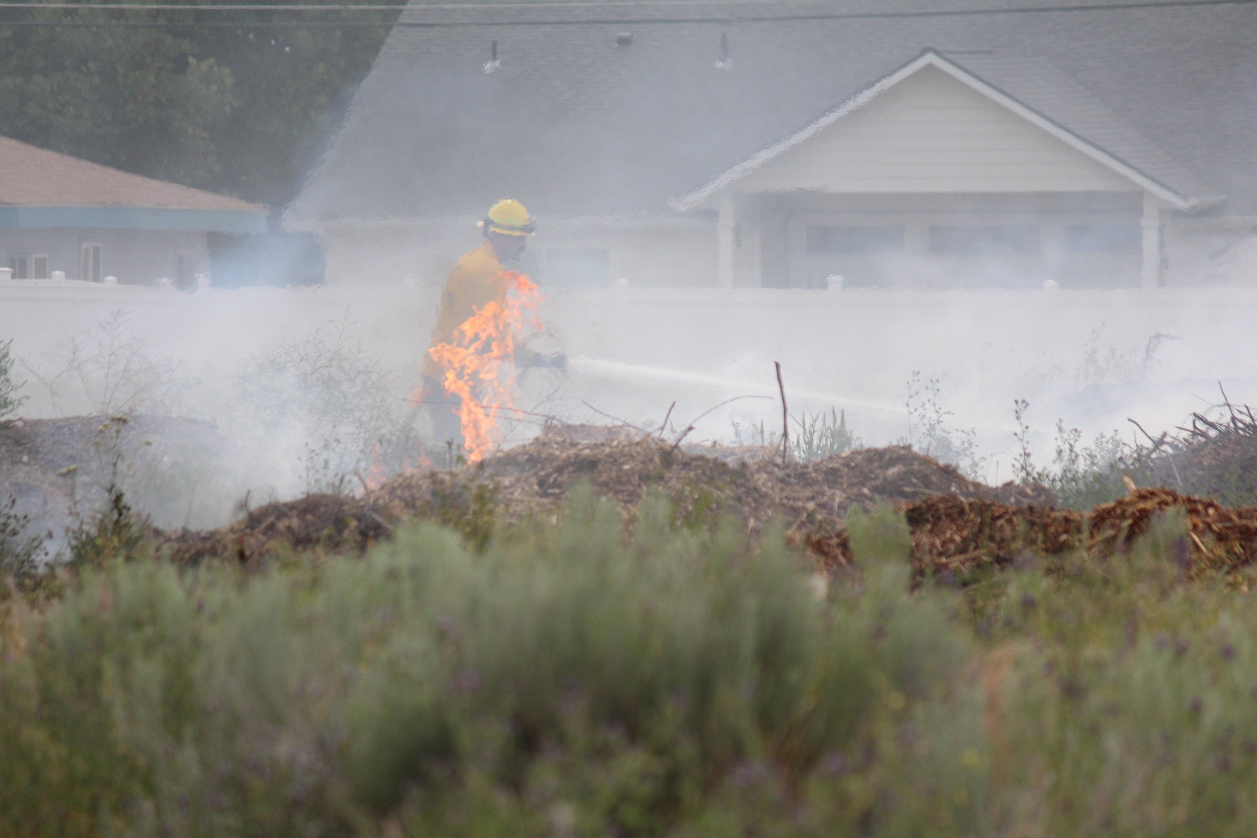 A Moses Lake firefighter tackles a flame in a field mid-June of 2025. This summer is slated to have warmer and dryer conditions due to the lack of precipitation in the winter of 2025/26 and the predicted short wet season in spring of 2026.
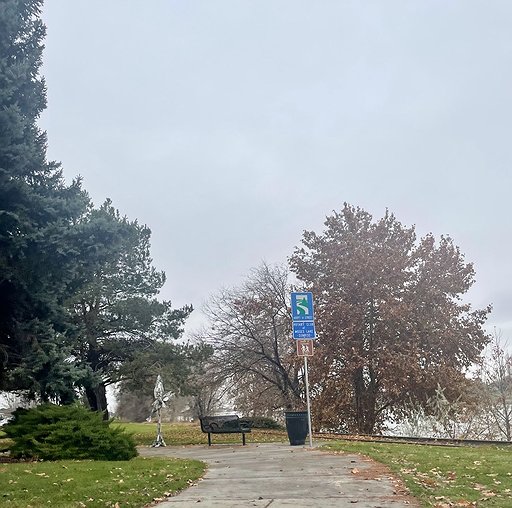 Gloomy skies over Neppel Landing in Moses Lake during the fall of 2025. The fall of 2026 is predicted to see a dry start to the season and will see very little precipitation.
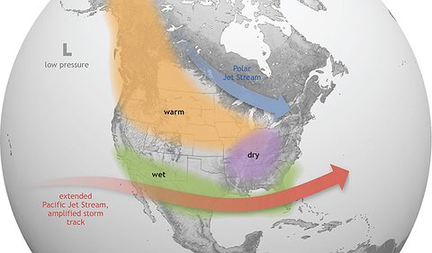 Map of El Nino weather patterns and how that impacts specific regions of the United States. With the PNW entering into El Nino in 2026, warmer and drier weather is expected.
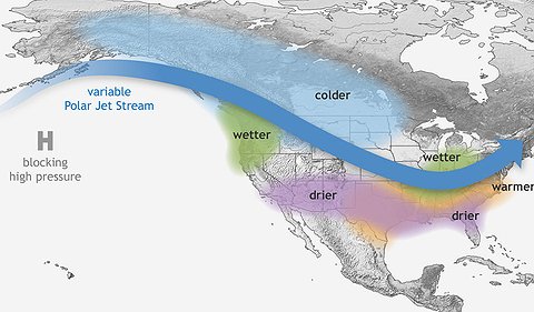 Map of La Nina weather patterns and how that impacts specific regions of the United States. Weather has been in the La Nina pattern for the last two years and will be transitioning into El Nino in early March.