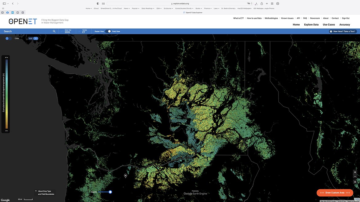
A screenshot of the OpenET mapping website with a focus on Washington state. The darker green areas show greater evaporation of water, and in Central Washington, shows very clearly the extent of irrigated acres in the Columbia Basin Project as compared with dry farm wheat and barley land to the east and north.
January 21, 2022
Stories this photo appears in:
January 21, 2022 1 a.m.
On the map: Open source technology lets farmers conserve precious water
CRANE, Ore. — Mark Owens said his desire to conserve water began in earnest way back in 2015.